BE CAREFUL WHEN WALKING ON ROCKS, NOTE THE HEIGHT OF THE TIDE AS IT IS EASY TO GET CAUGHT.
Portmarnock to Malahide Coastline
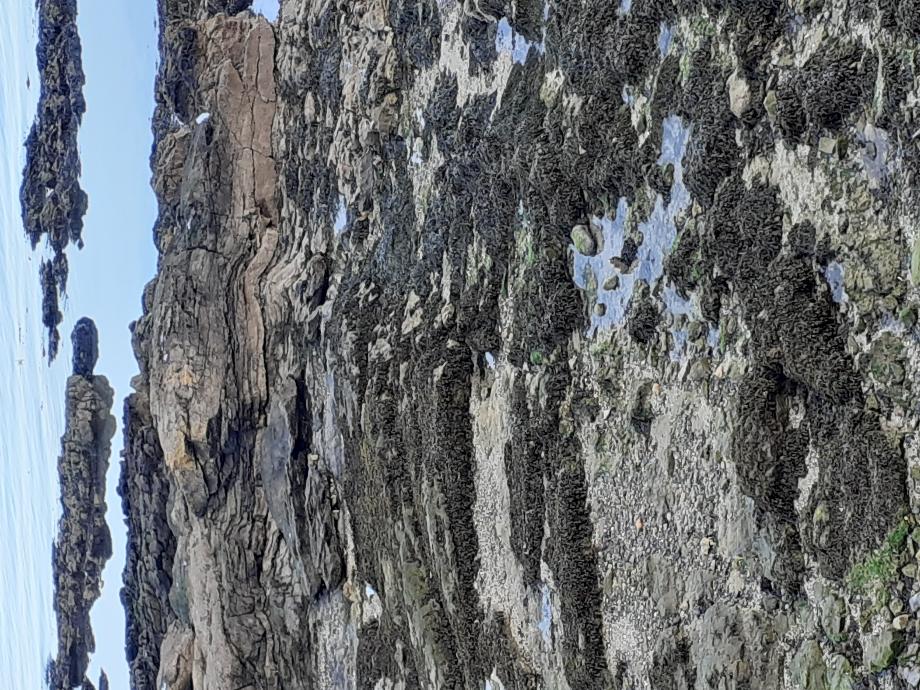
This coastal section of Carboniferous Limestone rocks shows a diverse range of fossils fauna. There are 3 faults in this section, but this is the only near-continuous section of fossiliferous Lower Carboniferous Limestone age rocks near Dublin and the large quantity and variety of fosslis make this a very interesting location.
Starting at the Southern end of the exposure, just North of the Velvet Strand.
Make your way down the steps to the beach and turn left towards the Martello tower.
Geology Stop 1
The rocks on which you are now standing were formed on the floor of a warm tropical sea some 340 million years ago when Ireland was situated just North of the equator ( it has been drifting steadily north ever since) http://geoschol.com/periods.html These rocks have been dated by the fossils they contain ( crinoids and conodonts) and belong to the early part of the Carboniferous Period. At that time the Wicklow mountains formed a landmass to the south, and there was also a landmass just north of Skerries, such that Malahide and Portmarnock were in a small marine trough running roughly east-west. broadening out into a large shelf in both directions.
You will notice that some of the rocks here have a rather rubbly appearance, in which there is a fine lime-mudstone matrix containing some subrounded to angular limestone fragments or clasts, ranging in size from 4cm to 80 cm. These beds formed by bits of rock slumping down from the shelf above, and getting stuck in the lime mud flooring of the trough. Nearby you can distinguish a 6m long lens shaped block surrounded by relatively fragmented limestone ( breccia), which is conspicuous due to orangy-brown weathering and more intense veining than the surrounding rocks. This whole block has slid down from above, which is why it looks different from it’s surroundings, and doesn’t form part of a continuous bed.
Interbedded with the pebbly beds are darker more shaly beds in which a planar fabric running through the rocks is seen ( rock cleavage). This developed after the rocks formation, by parallel alignment of platy minerals when the rocks were intensely squeezed during the period of mountain building which was responsible for amongst others the Hartz mountains in Germany and the Vosges mountains in France. Variscan Orogeny. https://www.geolsoc.org.uk/Plate-Tectonics/Chap4-Plate-Tectonics-of-the-UK/Variscan-Orogeny It was also at this time that the beds of rock that were originally laid down horizontally on the seafloor, were tilted up to the 45° angle at which they now lie.
Some of these darker more muddy beds are rich in crinoid debris ( the remains of animals called sea-lilies, related to sea urchins and starfish). Crinoids lived anchored to the seafloor by long stems made up of many ‘polo-mint’ types of rings of shell, with soft tissue running down the hole in the middle. The individual rings of ossicles often separated from each other after death and show up in the rocks as little white circles, or may be weathered out in 3 dimensions. On top of the stem was the body chamber covered with shelly pates, and a series of food gathering arms or tentacles, also covered with shelly ossicles. Although some 80 species of crinoid still exist, they were much more common and diverse during the Carboniferous times; with their broken-up skeletons making a sizeable contribution to the formation of many limestones. Other common fossils here are bryozoans ( sea-mats) which were small animals living in colonies attached to the sea floor or a shell. Each colony consisted of hundreds of individuals ( zooids) looking a bit like baby sea anemones, although they are in fact quite different. Each zooid made itself a protective outer shell and these joined together to make quite a large structure, in the form of an upstanding fanor cone ( fenestrellids), a stick or brush, or an encrusting mat. There are approximately 4,000 living species of bryozoans, and at least 15-20,000 fossil species are known.
Geology Stop 2
As you walk across the beach towards the Martello Tower you will pass the 3m to 4m high cliffs of glacial till deposited on the Carboniferous shales and mudstones during the last Ice age( in Pleistocene times between 2 million and 11 million years ago). Contained in the rather muddy matrix there are several types of angular to sub-angular clasts, ranging in size from 5mm to 40mm. Towards the base, the clasts tend to be coarser and to include several fragments of the underlying mudstone. Close examination will also reveal, amongst others: clasts of red sandstone, green volcanics, black mudstone, dark chert and white vein quartz. The jumbled and angular nature of the included fragments is typical of sediments deposited by ice.
Geology Stop 3
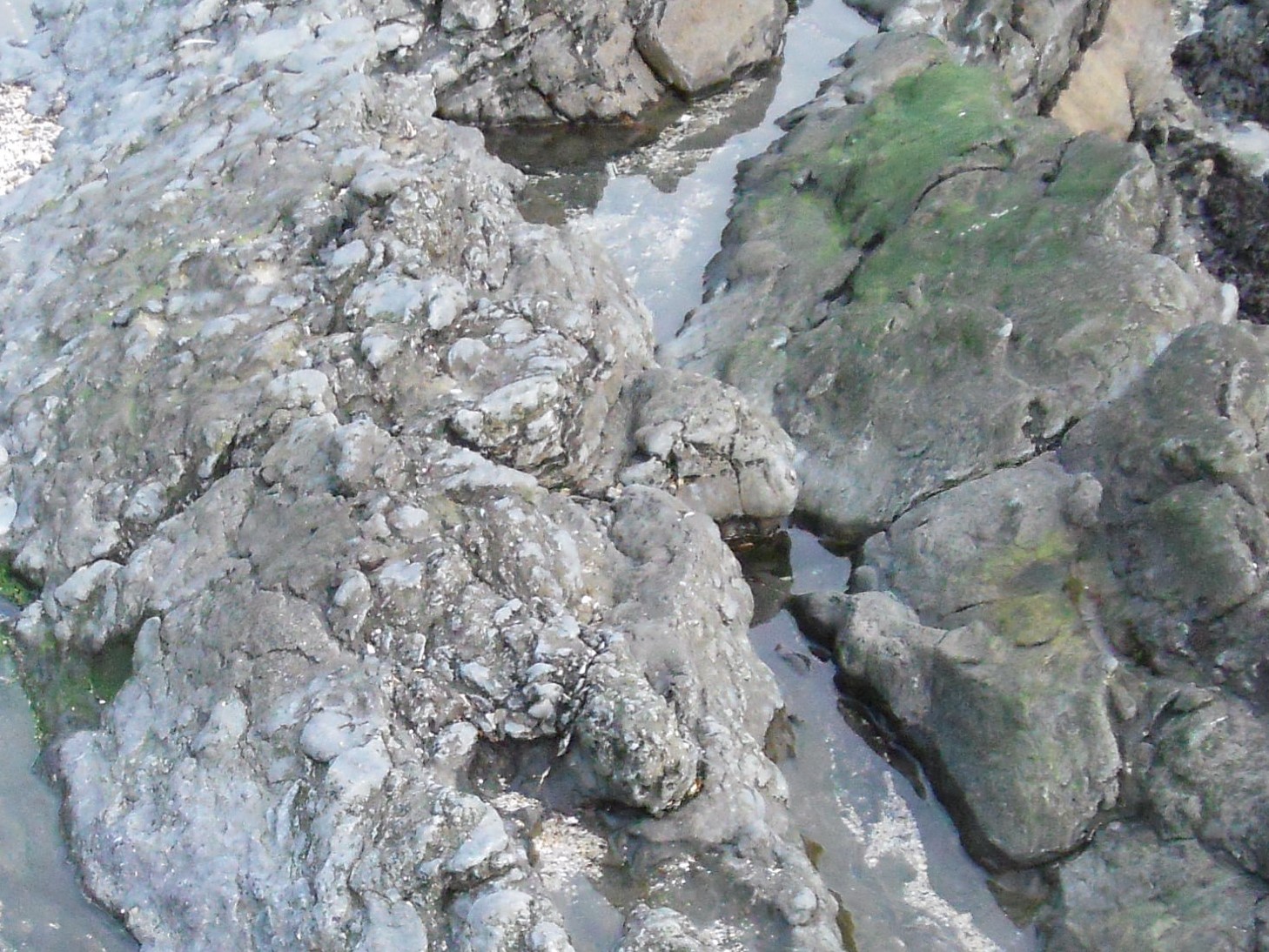
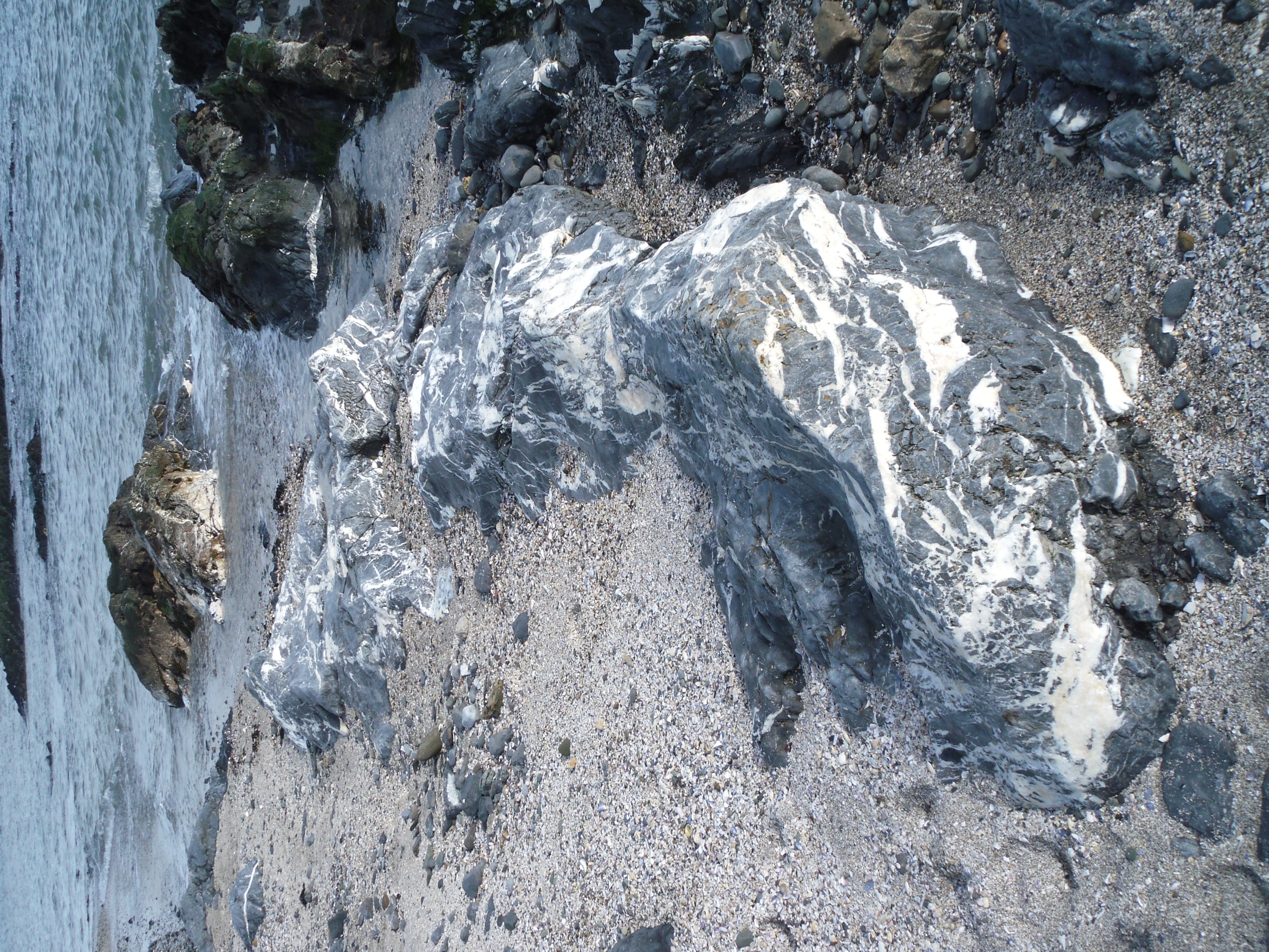
In the rocks beneath the Martello Tower there are spectacular white veins of the mineral calcite.If you look closely you can see that the little (1mm to 2mm) fragments breaking off from the veins are rhomb shaped ( fragments breaking off from quartz veins have an irregular shape) Veins form later than the rocks themselves, when tectonic squeezing produces cracks in the rocks. Hot liquids containing dissolved calcite then flow up through the cracks, and the calcite crystallises out of the fluid onto the walls of the crack gradually filling up all the available space- as happens in areas of hard water when a kettle get furred up with limestone. Intense veining ofern marks the site of a fault, and that is the case here. A fault, which is hard to make out on the beach but passes inland through the grounds of Malahide Castle, has caused slightly older Carboniferous to lie at the surface next to the rocks you first examined ( Stop 1) From now on, as you walk along the section, the rocks will get progressively younger ( although the sequence is disturbed by small-scale faulting and folding).
Geology Stop 4
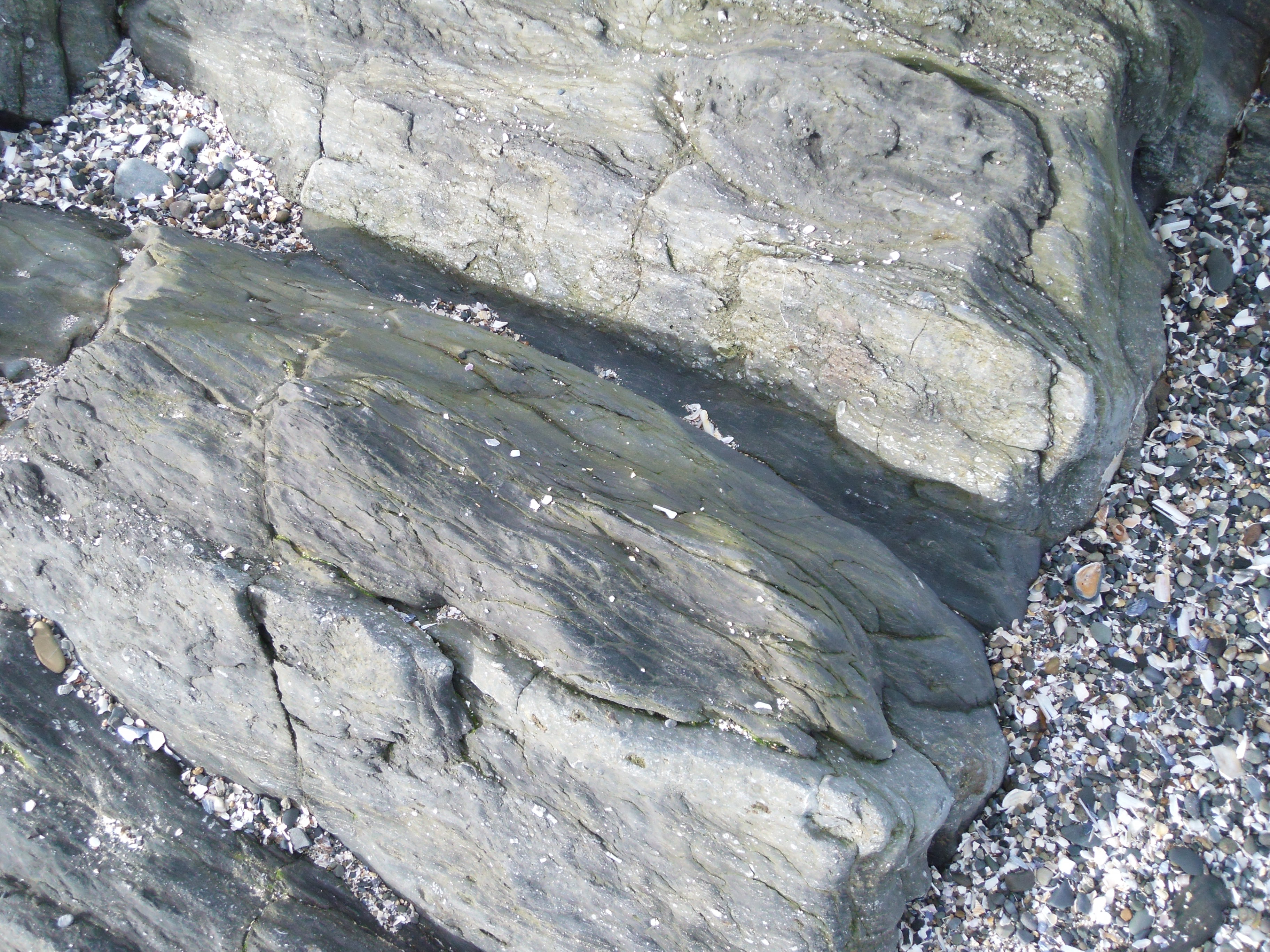
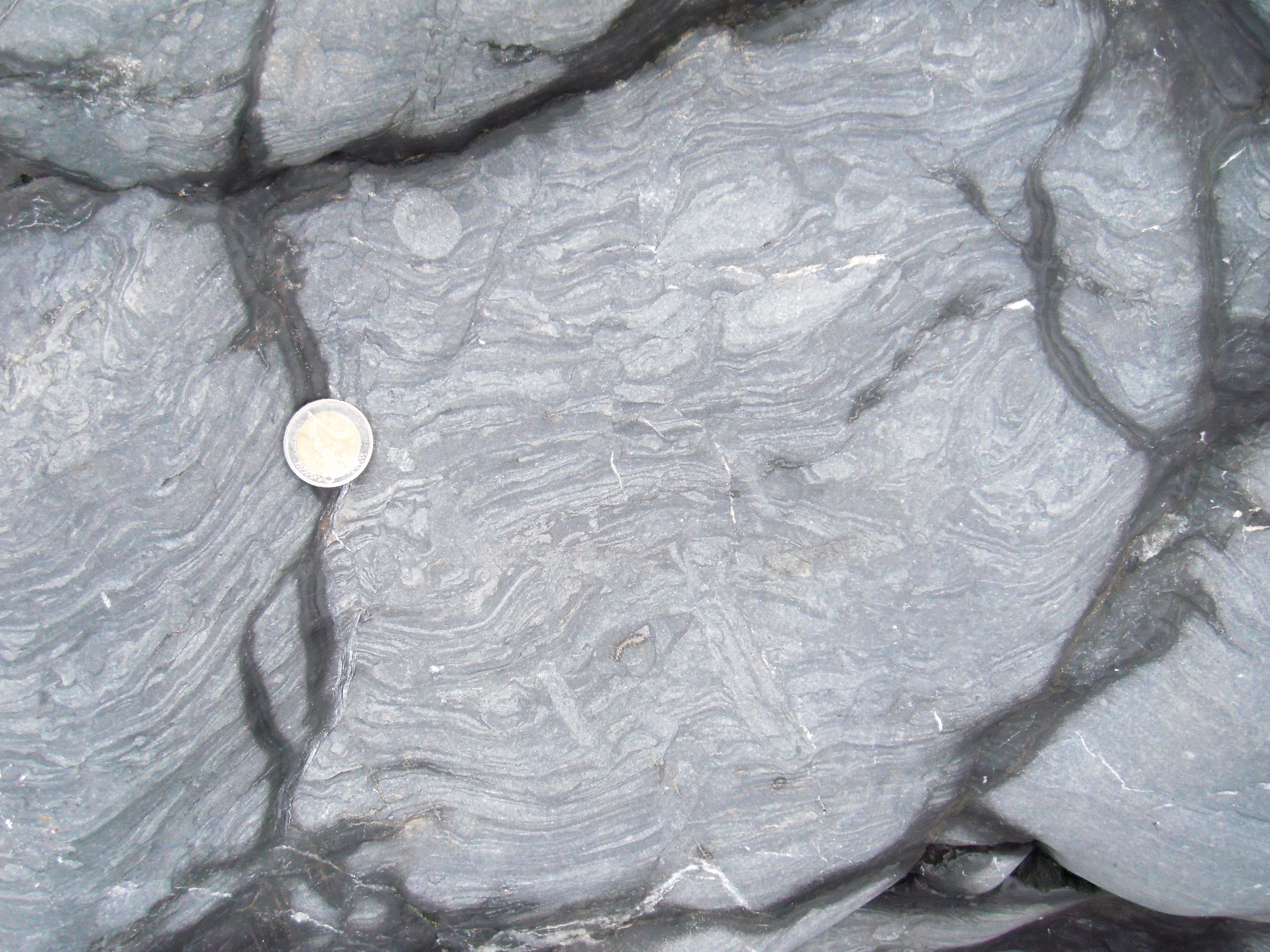
Approximately 40m north of the Martello Tower the dark limestone is made up of finely laminated micrites ( rocks made up of very fine crystals of calcite), and 1mm scale ripples of alternating light and dark grey are particularly clear on wetted surfaces. Also infilled animal burrows ( possibly made by marine worms) can be seen preserved a lighter grey ovals and circles ( 2cm to 3cm) standing slightly proud of the rock surface. It seems that these rocks were deposited in rather shallow, possibly tidal, environment. Occasional crinoid ossicles and locally abundant bryozoans, appearing as delicate wriggly white lines, are also seen here.
Geology Stop 5
A short way further on, the beds of the rock stop dipping away to the SE and dip instead to the NE; this is because you have crossed a fold in the rocks ( such convex- upwards folds are called anticlines, folds the other way are called synclines)

Geology Stop 6
Roughly 20m further north along the beach from the fold axis, just before a small headland where there are boulders placed on the foreshore to prevent erosion, a single bed rich in brachiopods is crossed. These show up as 4cm to 2cm white structures in the rocks. Brachiopods ( commonly called lamp shells because of their resemblance to Roman oil lamps) were animals which grew a 2 valved shell. At first sight they look similar to modern day molluscan bivalves such as cockles, but their internal soft tissue was markedly different and the 2 valves were different sizes; unlike molluscan bivalves. Most brachiopods lived attached to the sea floor by a stalk called a pedicle. The 2 parts were hinged at the end with the stalk and the back of the shell could be gaped open to allow sea water to waft inside so that it could be sifted for food particles. Brachiopods were extremely common in the past and well over 2,500 fossil genera are known, although there are only about 70 genera living today.
Geology Stop 7
As the concrete outlet pipe, which runs across the beach to the sea, is approached, the number of different types of fossils increases, and this may be a reflection of the gradually deepening water conditions through the time of these rocks deposition. Corals of the genus Lithostrotion become more common and appear as 20cm ( or so) clumps of lighter coloured spheres and ovals ( marking the tops of individual coral pipes., many of which stand proud of the bedding plane surfaces, due to the greater resistance to erosion. It now becomes much easier to envisage that you are walking across the bottom of an ancient coral sea, and individual coral clumps can be found in vertical cross-section where the beds are broken off suitably, showing that the corals are preserved in life position. Large gastropods ( snails) appear as 3 cm to 4 cm lighter coloured spirals, or three chambered geometric shapes if preserved in cross section. Also there are patches of relatively fine crinoid debris.
Geology Stop 8
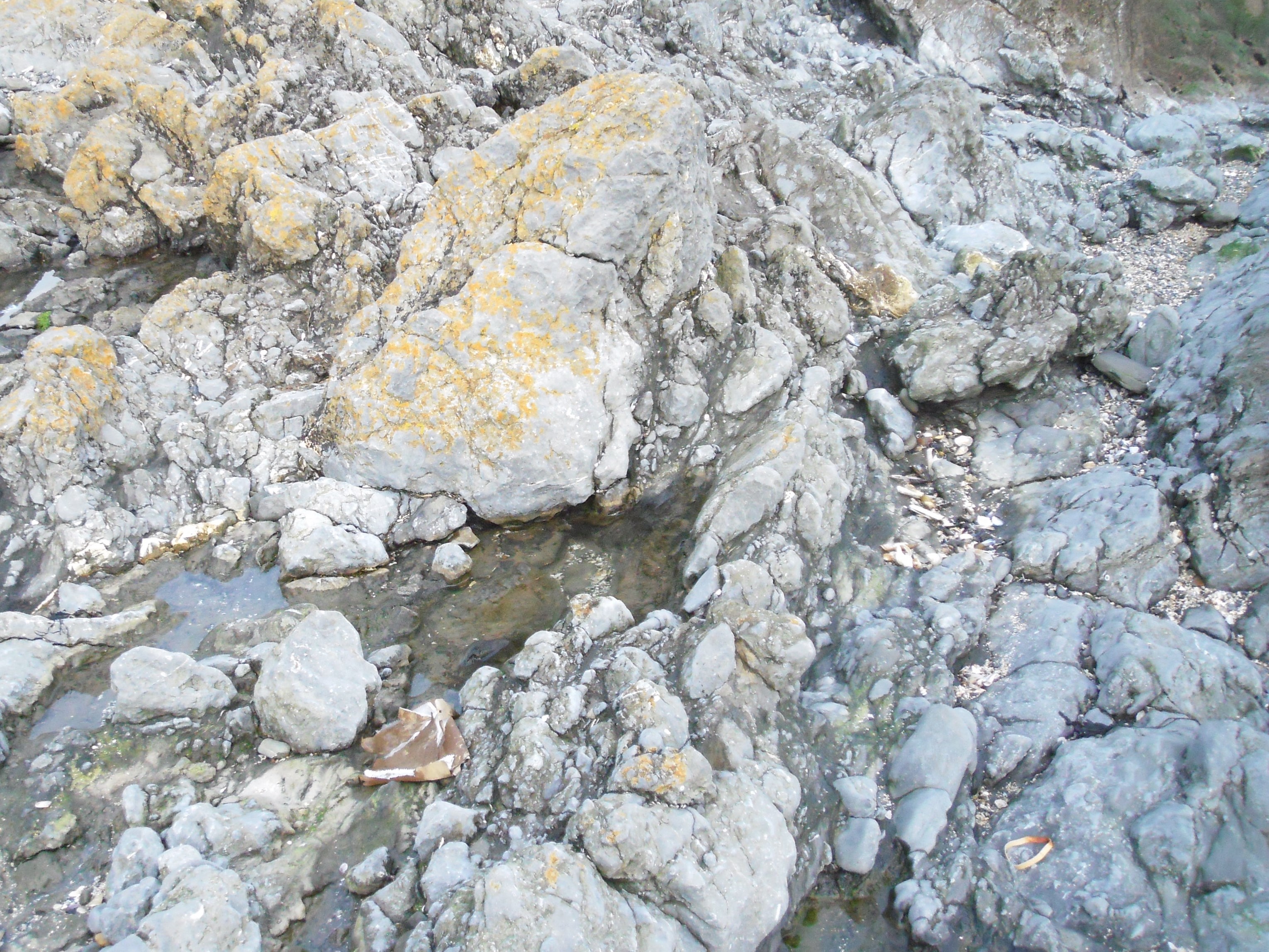
Approximately 50 m beyond the concrete pipe, there is a spot in the cliff where the boundary between the till and the underlying limestone is particularly clear. This contact is called an unconformity, that is to say a point in a geological sequence representing a major break in time. The interval between the deposition of the limestone and glacial till is something like 340 million years. Also at this point there is water rich in dissolved calcium carbonate dripping down onto the beach. Once in contact with the air, much of the calcium carbonate comes out of solution and crystallises on whatever the water happens to be dripping over at the time. The lime deposit formed is called a tufa or dripstone , and is what makes up the spectacular stalactites and organ pipes sheets seen in some caves. In the past, such places as this were termed dripping wells, and many were thought to have mystical significance because by placing an object ( such as a leaf) under the drips, a stone replica could be produced, often within a couple of weeks, in very lime rich waters. There is a case of someone on a caving expedition finding a pair of petrified pair of gloves formed in this way.
Geology Stop 9
As the little headland marking the northern end of the bay is approached there are spectacular vein systems developed- some enechilon patterns probably marking the outcropping of the top of a particularly thick vein. Once the headland is rounded, the socalled Coastguard Fault dipping steeply southwards, is seen on the cliffs. There is a well-defined wall of rock the southern edge of the fault plane as it runs down across the beach, this is termed the hanging wall as it is on the upper side. Faults such as this mark a point where there been considerable movement along a fracture, and when two rock masses rubbed past each other, their surfaces got broken up and crushed into small pieces to form fault breccia and fault gouge ( or rock flour) respectively, and both of these can be seen in the cliff. On the north side there is also disrupted bedding, typical of faults. The normal limestone distinctive orangy colour. This alternation involves magnesium being substituted into the limestone and is related to hot fluids coming up from depth and reacting chemically with the surrounding rocks. Faults are often mineralised by hot fluids, and lead ore ( galena), tin ore ( sphalerite) and a coppery type of fools gold ( chalcopyrite) occur in small amounts here and are associated with two small faults ( marked my a rust-stained breccia) just beyond the next small headland.
Geology Step 10
A short way beyond the Coastguard Fault, where a path descends from a layby at the cliff top, well preserved brachiopods of several species are seen in the rocks at the foot of the cliff. Between here and the concrete fishing jetty ( where the steps lead up to the road ( marking the end of this excursion) the rocks ontain beautifully preserved bryozoans of at least 4 species, which weather out clearly on bedding surfaces. These are particularly clear on the lichen covered rocks near the waters edge. Whole brachiopods and large fragments of crinoid columns can be seen in the darker, more shaly beds on the cliff.
Geology Stop 4
Approximately 40m north of the Martello Tower the dark limestone is made up of finely laminated micrites ( rocks made up of very fine crystals of calcite), and 1mm scale ripples of alternating light and dark grey are particularly clear on wetted surfaces. Also infilled animal burrows ( possibly made by marine worms) can be seen preserved a lighter grey ovals and circles ( 2cm to 3cm) standing slightly proud of the rock surface. It seems that these rocks were deposited in rather shallow, possibly tidal, environment. Occasional crinoid ossicles and locally abundant bryozoans, appearing as delicate wriggly white lines, are also seen here.